Projects
RPI’s focus is the unique and unparalleled potential of uniting natural resource expertise with spatial and information processing capabilities.
-
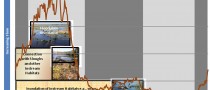
Drinking Water Unusually Sensitive Areas (USAs) , Nationwide , U.S. Department of Transportation, Pipeline and Hazardous Materials Safety Administration
-
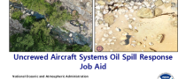
Oil Spill Response Uncrewed Aircraft Systems (UAS) Guidance and Training Job Aid , U.S. Coast Guard Great Lakes Center of Expertise (GLCOE), in partnership with NOAA

-
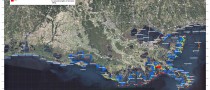
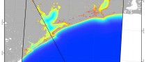
Gulf of Mexico All-Hazards Risk/Threat Assessment , September 2015 , 73 coastal counties and parishes in the Gulf of Mexico , Disaster Response Center, NOAA
-
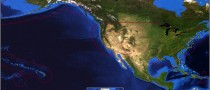
BOEM Worldwide Synthesis Alternative Energy , Worldwide
-
Superstorm Sandy Debris Mapping and Modeling , July 2014 , New Jersey, New York, Connecticut , Marine Debris Program, NOAA
-
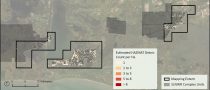
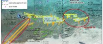
Extent of Subsurface Lingering Oil from the Exxon Valdez Oil Spill , February 2016 , Prince William Sound and the Gulf of Alaska , Exxon Valdez Oil Spill Trustee Council
-
NEPA Analysis and Subject Matter Expertise for Offshore Wind Projects , 2020 - ongoing , Offshore New England
-
Nonfloating Oil Containment and Recovery , 2016-2017 , USA , American Petroleum Institute
-
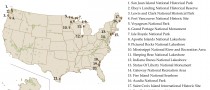
National Park Service Contingency Planning , 21 National Park Service parks, monuments, historic sites, and recreation areas nationwide , Spill Response Program, NPS
-
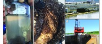
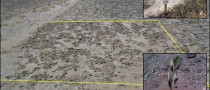
Identification and Quantification of Hazardous Materials and Other Man-made Debris after Hurricane Laura , 2021 , Southwest Louisiana National Wildlife Refuge Complex , US Fish and Wildlife Service
-
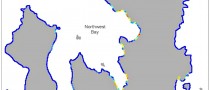
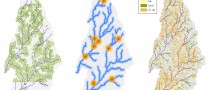
Floodplain and Instream Habitat Analysis in Support of Minimum Flows and Levels for the St. Marks River Rise, Wakulla, and Sally Ward Springs System , Florida , NW Florida Water Management District
-
Deepwater Horizon Programmatic Environmental Impact Statement (PEIS) , Gulf of Mexico , National Oceanic and Atmospheric Administration
-
Job Aids for Small Uncrewed Aircraft Systems for Spill and Hurricane Response , National Oceanic and Atmospheric Administration, Office of Response and Restoration, Emergency Response Division
-
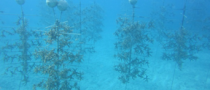
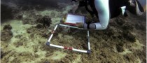
Seagrass Restoration Following Damage during Hurricane Responses , St. Croix, U.S. Virgin Islands , National Oceanic and Atmospheric Administration
-
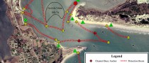
Automated Post-Disaster Vessel and Debris Mapping Models , St. Croix, U.S. Virgin Islands , National Oceanic and Atmospheric Administration
-
Texas City Y Oil Spill Natural Resource Damage Assessment (NRDA) , Texas , U.S. Department of the Interior, U.S. Fish and Wildlife Service
-
Federal Agency Consultations for Coastal Debris Removal Following Hurricanes Florence, Michael, and Typhoon Yutu , Florida, North Carolina, and the Commonwealth of the Northern Mariana Islands (CNMI) in the South Pacific , National Oceanic and Atmospheric Administration, Office of Response and Restoration, Marine Debris Program
-
Biological Assessment for the Preauthorized Use of Dispersant & In-Situ Burn Operations , USA , USCG, USEPA
-
NOAA Marine Debris Program’s Abandoned and Derelict Vessel InfoHub Project
-
Guidelines for Ephemeral Data Collection in the Arctic
-
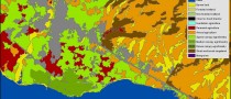
Development of a Climate Change Vulnerability Tool for the National Natural Park “Corales del Rosario y San Bernardo”, Colombia
-
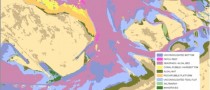
Environmental Sensitivity Index (ESI) Mapping
-
NOAA Spill Response Support , 1978 - present , USA (nation-wide) , NOAA
-
Applied Oil Spill Research and Monitoring
-
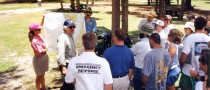
Oil Spill Training Courses
-
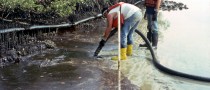
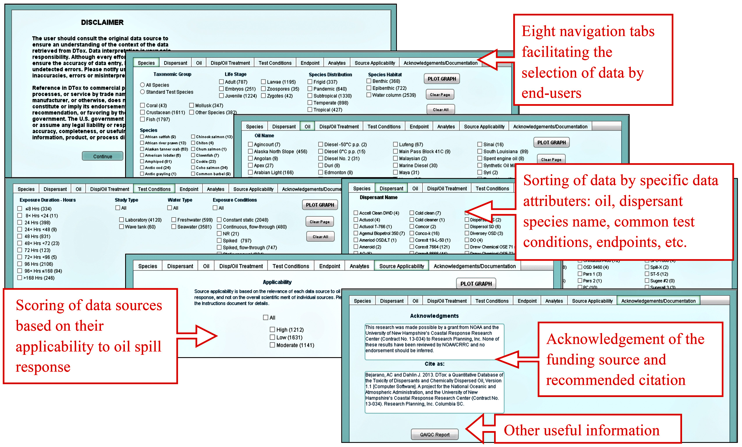
DTox: a Worldwide Quantitative Database of the Toxicity of Dispersants and Chemically Dispersed Oil , January 2013 - January 2014 , Coastal Response Research Center
-
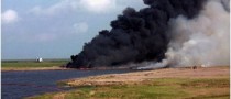
Deepwater Horizon / MC252 Response , 2010 , USA , NOAA
-
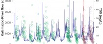
Kalamazoo River Oil Spill - Net Environmental Benefit Analysis , Michigan, USA
-
Chemical Aquatic Fate and Effects (CAFE): a database for rapid response to chemical spills in aquatic environments , NOAA Emergency Response Division

-
Jeddah Coastal Pollution Assessment , Jeddah
-
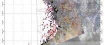
Analysis of Contaminated Sediments in Garden Island Bay , GardenIsland Bay, Louisiana , NOAA
-
Post Storm Marine Debris Surveys Data Management and Modeling , Louisiana, Mississippi, and Alabama , NOAA
-
Abu Dhabi Habitat Mapping Change Analysis , United Arab Emirates , Pandion Technologies, Ltd
-
Software Tools for Habitat Equivalency Analysis
-
Assessment of Marsh Recovery after the Chalk Point Oil Spill , 2000 , Patuxent River
-
Caribbean and Pacific Island Abandoned Vessel Surveys , 2002-2003 , Caribbean and Pacific , NOAA

-
Pago Pago Coral Reef Grounding Impact Assessment
-
Coastal Resources Atlas and Vulnerability Index for the Emirate of Abu Dhabi
-
Office of Pipeline Safety (OPS) Unusually Sensitive Areas (USAs) , Research and Special Programs Administration (RSPA) of the DOT Office of Pipeline Safety
-
Tidal Inlet Protection (TIPS) Strategies
-
Natural Resource Damage Assessment (NRDA) Support for Natural Resource Trustees
-
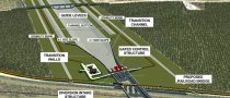
Route Selection and Environmental Impact Statement (EIS) for Electrical Transmission Corridor
-
West Africa Gas Pipeline (WAGP)

-
Environmental Assessment Keta Sea Defense Works Project (KSDW)

-
Coastal Geomorphology and Engineering Support for Development of the Kuwait City Waterfront Master plan , Kuwait City , Municipality of Kuwait

-
Draft Regulations for the Prevention of Coastal Erosion in Oman , Oman
-
Al Gharbia Master Plan Physical Setting Characterization , Al Gahrbi , Urban Planning Council of the Emirate of Abu Dhabi
-
BOEM Environmental Support , Bureau of Ocean Energy Management, BOEM
-
Mid-Barataria Sediment Diversion Environmental Impact Statement (EIS) , Louisiana , U.S. Army Corps of Engineers, New Orleans District
-
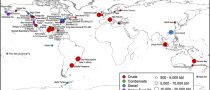
BOEM Oil Spill Literature Syntheses , Worldwide , Bureau of Ocean Energy Management, BOEM
-
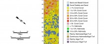
Programmatic Environmental Impact Statement for the NOAA Coral Reef Conservation Program , National Oceanic and Atmospheric Administration, Office of Coastal Management
-
Minimum Flows and Levels Support to the Suwannee River Water Management District , Florida Gulf Coast , Suwannee River Water Management District

-
Haiti WINNER (Watershed Initiative for National Natural Environmental Resources) , Haiti
-
2012 Risk Assessment for Potentially Polluting Wrecks in US Waters
-
Water Resources and Floodplain Management
-
Remediation and Restoration of Gulf Coast of Saudi Arabia
-
Artificial Reef Site Selection Study: Arabian Gulf
-
Oiled Shoreline Survey – Kingdom of Saudi Arabia , 2002-2003 , Saudi Arabia