In order to inform users of the best practices for flying UAS during an oil spill or natural disaster response and/or damage assessment, this set of job aids (practical and data management) were developed in partnership with NOAA’s Office of Response and Restoration (ORR) for the US Coast Guard Great Lakes Center of Expertise. These two job aids help the USCG operationalize their drone fleet for Marine Environmental Response (MER) missions across the country, as well as providing guidance to other responders, such as other government agencies and Oil Spill Response Organizations (OSROs).
By using the Uncrewed Aircraft Systems (UAS) Guidance and Training job aid, UAS pilots will be able to select appropriate payloads and settings as well as create effective flight plans for delivering high quality data to the response. Using the Data Management, Storage, and Delivery Guidance job aid, the user will be able to use correct file naming conventions and upload data into NOAA’s Data Integration Visualization Exploration and Reporting (DIVER) application, where it can be visualized in the common operating picture, the Environmental Response Management Application (ERMA). To accompany the job aids, RPI created narrated presentations of two topics in the job aids: making aerial observations of oil on water and using UAS for Shoreline Cleanup Assessment Technique (SCAT).
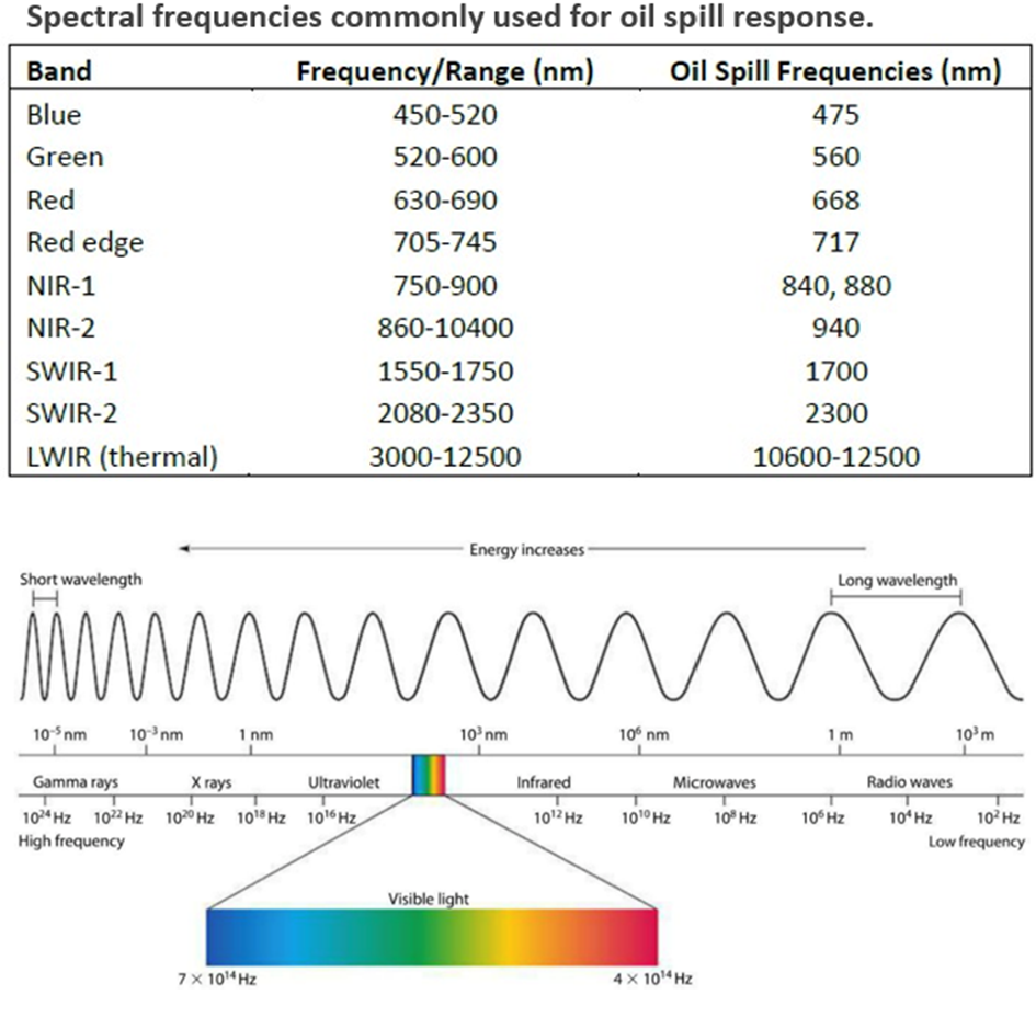
Along with these job aids, RPI also delivered a two-sided “One-Pager” quick reference with a matrix highlighting the aerial platforms and sensors most commonly used for oil spill response, when to use them, and how they are used. This quick reference also describes some of the strengths and weaknesses of the various platforms.
These job aids are living documents and subject to updates when necessary. All materials related to this project can be downloaded from ORR’s Uncrewed Aircraft Systems Guidance for Oil Spill and Disaster Response, Assessment, and Data Management page.
Electromagnetic spectrum. Credit: Descartes Labs