Projects to date to support the Suwannee River Water Management District’s (SRWMD) Minimum Flows and Levels (MFL) program include: the Conceptual Plan for Habitat and Faunal Inventories and Analysis in Support of MFLs for SRWMD Coastal Rivers (2019); Ecological Data Collection, Analysis, and Reporting for the Estuarine and Freshwater Reaches of the Tidal Portions of the Waccasassa River (2020); and the Analysis of Floodplain Vegetation, Soils, and Hydrologic Indicators in Support of MFL Development for the Upper Santa Fe River (2021).
The Conceptual Plan for the Coastal Rivers identified ecological data needs and developed a study design for data collection and analysis to supplement earlier data collection and analysis efforts focusing on the Aucilla, Econfina, Steinhatchee, and Waccasassa Rivers. RPI scientists used available data sources, combined with field verification, as a basis for identifying potential sampling transects and developing ecological data collection and statistical analysis approaches, to support MFL-related ecological data collection. The plan included schedules for implementation, cost estimates, and deliverables.
The Waccasassa River project included ecological data collection and analysis necessary to quantitatively characterize plant and benthic invertebrate communities along the Waccasassa River, as described in the Conceptual Plan. A total of 16 transects were established in salt marshes, coastal hydric hammock, and freshwater tidal forest along the river. Vegetation, salinity, water level, soils, and benthic invertebrate data were collected at random locations along each transect. Data were paired with corresponding elevation data and used to calculate plant species Importance Values (IVs) for the floodplain. Discriminant function analysis was used to identify variables that could be used to predict vegetation classes, and subsequent analyses were used to examine differences in vegetation classes and benthic invertebrate metrics. This study was the first quantitative analysis of vegetation and associated environmental parameters along the tidal Waccasassa River. The Santa Fe River project also included ecological data collection, this time along the spring-fed Upper Santa Fe River from Olustee Creek to Santa Fe River Sink, where the river flows into the sink before re-emerging approximately three miles downstream. Data were compiled in GIS formats for spatial analysis and analyzed using R statistical software (both parametric and nonparametric analyses). Elevation, soils, and vegetation classes were more variable at upstream transects than at downstream transects. Upstream vegetation and river morphology were characterized by steep riverbanks, sandy ridges, and narrow floodplain forests, compared with broader, wetter, floodplain forests and more subdued elevation changes downstream, indicating potentially greater vulnerability to changes in flows in the downstream portion of the river.
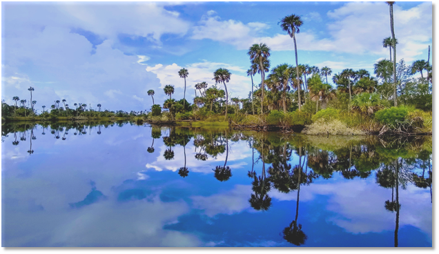 The Waccasassa River in the Suwannee River Water Management District of Florida.