Goal: Improve Modeling Capabilities for Post-storm Prediction of Marine Debris
Methods and Products: RPI conducted imagery analysis (including initial Object-Based Image Analysis for rapid automated processing of spatially extensive marsh and other natural intertidal areas) and field validation surveys to determine debris detectability by type, then refined the marine debris model to better predict the location and density of marine debris from intense storms. We found that post-storm intertidal debris densities are most closely correlated with storm surge water elevations and population density, rather than storm wind speed.
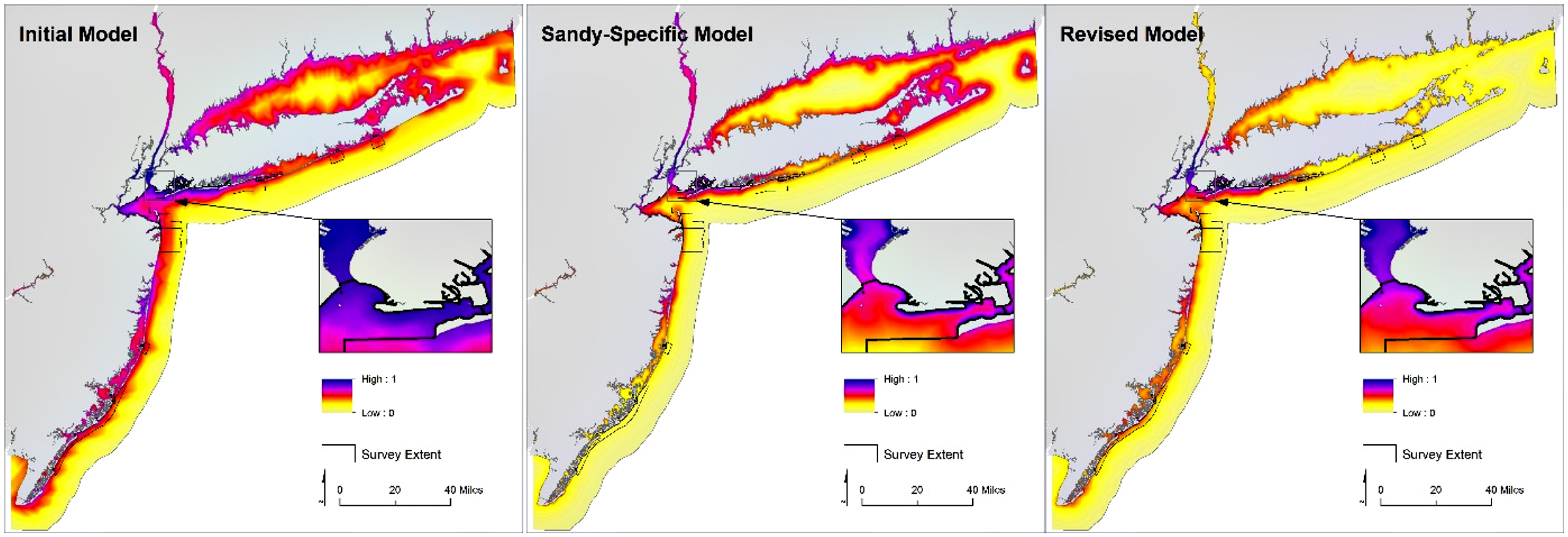
Relative debris item encounter probabilities estimated by the initial logistic model derived from Gulf of Mexico post-storm survey data (left), refined logistic models derived from Hurricane Sandy-specific survey data (center) and all pooled survey data (right) for the nearshore areas of New Jersey, New York, and Connecticut affected by landfall of Hurricane Sandy.