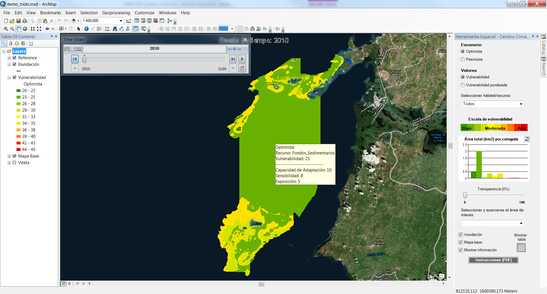
RPI, in partnership with the National Park Service and ICF International, coordinated the development of an interactive visualization tool that assesses the vulnerability of one of the Natural National Parks of Colombia to impacts associated with climate change (e.g., sea level rise, storm surge). The primary objectives of this project were to use area specific information to assess the vulnerability of coastal and marine habitats, and biological and socioeconomic resources, including infrastructure to several climate change factors. By integrating existing spatial information and vulnerability indices into a geo-referenced decision support visualization tool, agencies, stakeholders, the public and other interested parties could guide their management decisions and identify mitigation and adaptation strategies to better prepare them for the potential impacts from climate change.