RPI, under contract with Chemonics, is providing in-country and remote technical support for the USAID WINNER project goals of promoting increased agricultural productivity and watershed stability in Haiti. RPI is providing cartographic, data management, and analytical support to the various technical teams that make up the WINNER project with a focus on capacity building through the training of Haitian WINNER employees. Across the spectrum of WINNER activities, RPI has conducted landuse/landcover classifications, slope and terrain analysis, GPS field training, and road and path surveys and been responsible for database design, web data distribution, and technical workshops for community outreach. Additionally, following the 2010 earthquake, RPI was involved in damage assessment surveys and a variety of response oriented GIS tasks.


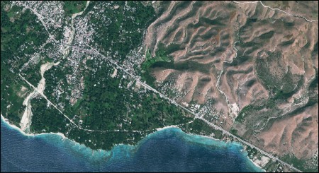
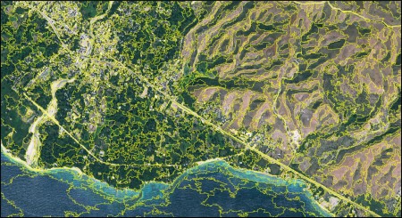
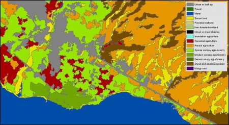
Figure 1. Example project workflow. True color WorldView2 2 m multispectral imagery (top), multiresolution segmentation (middle), and classified LULC data (bottom). Location: Montrouis, Haiti.
