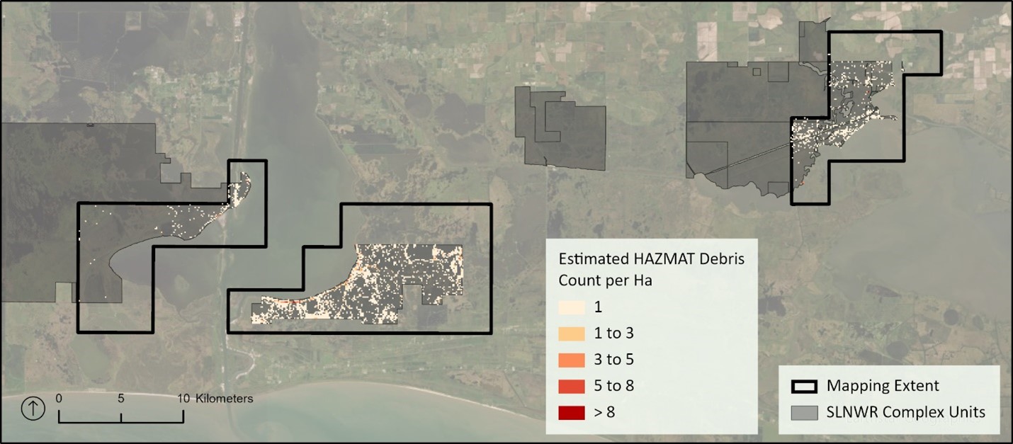
Hurricane Laura made landfall on 26 August 2020 near Cameron, Louisiana as a strong Category Four hurricane with winds up to 150 miles per hour and a storm surge of up to 17.2 feet. As a result, large amounts of hazardous materials and other man-made debris were deposited in the Sabine, Cameron Prairie, and Lacassine National Wildlife Refuges. Because assessment and removal activities after hurricanes on federal properties are not covered under the Stafford Act funding, RPI was contracted to assist the U.S. Fish and Wildlife Service in conducting an independent assessment of the locations and amounts of debris on the lands they manage.
RPI used a phase approach that included: 1) identification on potential hazardous materials sources to prioritize areas within the refuges for further study; 2) automated debris item mapping from post-hurricane aerial imagery; 3) analyst validation and debris item classification; 4) field validation of mapping and classification using ground surveys and drone imagery; 5) accuracy and detectability assessment; and 6) actual and statistical estimates of debris counts and density. The statistically estimated number debris items within the mapped extent in the refuges was 390 hazardous materials items and 23,000 other debris items.